
Description
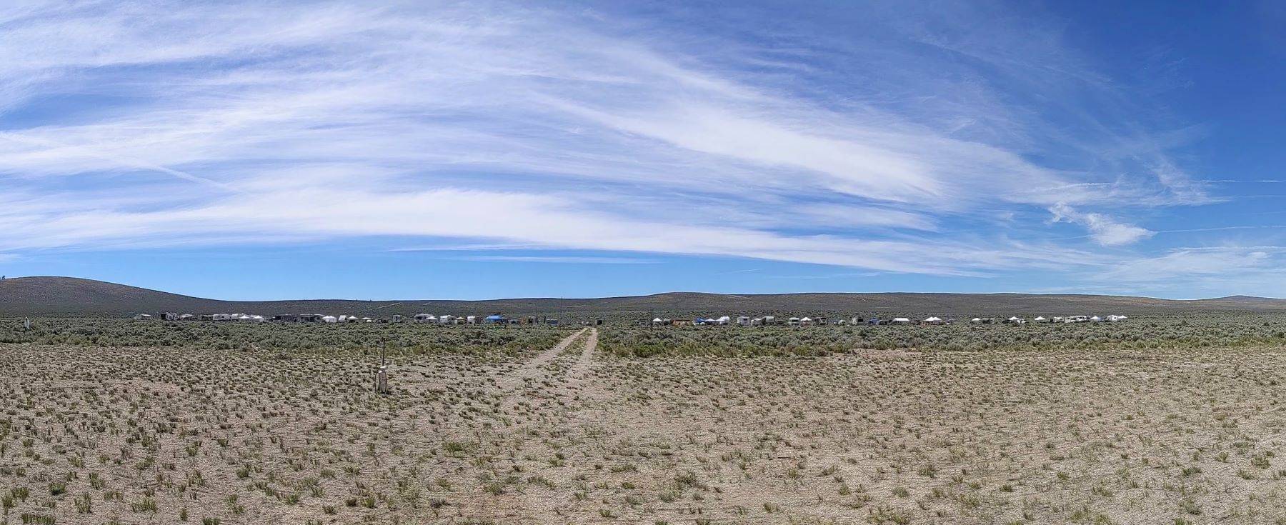
The Brothers site is Oregon’s premier launch site for large, complex and high altitude rocket projects. The site offers large, open space The location is sufficient in size to support several hundred flyers and spectators.
Quote from Rockets Magazine: One of the best kept secrets in rocketry is the launch site in Brothers, Oregon. The secluded location is perfect for high-power action that screams into the clear blue skies. You are truly committed to the hobby when you launch rockets with the Oregon Rocketry folks. One of the first questions a newcomer would ask is “How much recovery room do you have here?” Inevitably, the answer always comes back as another question, “How much do you need?”
Our actual waiver is good to 20,460′ AGL with call-in windows available as high as 36,636′ AGL depending on which cell you are launching from. Our recovery cylinder has a 4 nautical mile radius, truncated on the North by highway 20.
Location
The launch site is located at ~4,500 feet MSL (mean sea level) and approximately 5 miles southwest of Brothers, OR. Brothers is approximately 40 miles East of Bend, OR.
Top Things to Know About Flying at Brothers
1. Tracking is strongly recommended
The sagebrush around the Brothers launch site can make recovery difficult. GPS, RDF, or other tracking systems are strongly encouraged, especially for high flights, small rockets, minimum-diameter rockets, and flights expected to drift.
Even relatively small rockets can be difficult to locate in the sage.
2. The wind often builds through the day
Morning conditions are often the best flying window. Winds may increase as the day goes on, and flight decisions should account for drift, recovery distance, and safe return of the rocket.
Bring accurate simulations and be prepared to adjust flights based on actual field conditions.
3. The launch site is remote
The Brothers launch site is a significant distance from services. Come prepared with food, water, shade, sunscreen, medications, spare parts, tools, batteries, recovery gear, and anything else you may need for a long day on the range.
4. This is high desert flying
Depending upon the seasons, expect sun, dust, wind, dry air, cold nights, hot afternoons, and changing weather. At recent launches, we have had inches of snow in mid-May, and clear, calm days in the mid-60s in early November.
Bring plenty of water, sun protection, layered clothing, and secure shelter for shade and wind. Deep anchors (18in rebar) and ratchet straps for the pop-up tents is a good idea.
5. The community is part of the event
Flying at Brothers is not just about large flights. It is also a weekend for meeting other fliers, seeing interesting projects, helping with recovery, learning from experienced rocketeers, volunteering on the range, and sharing the sport.
Facilities
Water: no available water on-site. Occasionally there is water at the horse corrals at the Brothers Oasis rest stop, but it is not always operable. If you are coming from the West, the last location for water is Bend, if from the East, either Burns, Hines, or Riley.
Electricity: no. Solar, battery, or quiet generators are encouraged. Constantly-running generators are discouraged, and quiet hours are from 10pm to 7am.
Sewer/RV Dump: no – the nearest RV dump is Sinclair in Hines to the east, and Bend to the West.
Porta-potties: Yes, brought in for launches
Cellular Service: Yes
Food: No onsite food vendors
Gas: From the West, the closest gas is approximately 40 miles away, in Bend or Prineville.
From the East, Riley is 64 miles, and occasionally at Hampton – 23 miles away.
Restrictions
Fires: Campfires are only allowed in the two established fire rings on site. Many of us gather around the community fire ring each evening. No burning of sagebrush as firewood is allowed. The club usually has firewood, but you can also bring your own firewood.
Firearms: OROC requests that you leave your weapons at home for our events, or locked in a safe in your vehicle. There are no snakes at our location (they dislike the kitty litter style ground there).
Fireworks: No fireworks allowed.
Flight Waivers
Normal launches have an FAA waiver of 20,460′ AGL with call-in windows to ~36,600′ AGL. Please check for further details at each launch.
At the OROC Brothers launch site, fliers may fly up to N impulse, subject to pad assignment, waiver availability, range operations, and launch staff approval.
Depending on which pad area is used, the maximum altitude for the call-in waiver is limited as follows:
| Pad Area | Pad Distance | Maximum Altitude | Motor / Flight Notes |
|---|---|---|---|
| NW Away Cell | 1000 ft pads | 33,750 ft AGL | Up to single N or complex M |
| High Power North | 500 ft pads | 35,900 ft AGL | Up to single M or complex L |
| High Power East & West | 200 ft pads | 36,100 ft AGL | High-power A–G and up to single K |
| Low Power | 50 ft pads | 36,636 ft AGL | A–G low-power flights (good luck!) |
Requirements to Fly
OROC Launches at Brothers are generally run under Tripoli rules, this means that in addition to being either an OROC memeber or paying a launch fee, all fliers must be insured. Therefore:
- Adults wishing to fly at Brothers must be an insured member of TRA, NAR, or another recognized national club. Please have your membership card handy when you visit the registration table.
- Minors wishing to fly at Brothers must either be
- an insured member of TRA, NAR, or another recognized national club
OR - have a Tripoli Minors waiver on file, signed by a parent or guardian. We have hard copies at registration and the secretary tries to send them with ID cards for new members if there appears to be a need for one.
- an insured member of TRA, NAR, or another recognized national club
Maps and Directions
Reference Map


The access road gate is almost exactly 5 miles East of HWY 27, and 1.8 miles West of the Brothers Stage Stop.
Gate Coordinates:
43.8229, -120.6377
43°49’22.4″N 120°38’15.7″W
Google Map
Bing Map
Launch Site coordinates:
43.799278, -120.650169
43°47’57.4″N 120°39’00.6″W
Bing Map
Google Map
Brothers is 40 miles from the last “cheap” gas and water. Please be equipped to handle any auto mechanical difficulties you may have. The last 2 miles from the highway is unimproved road; a car with decent ground clearance is highly advised.
Important note: Online maps may either guide you all the way to Brothers, then tell you to turn South and cut back to the West to get to the launch site; or they will tell you to turn off the highway just after mile marker 39 at a gate with wooden fence posts. Both of these routes are technically possible, but these roads are even less used and require significantly more vehicle clearance. Please follow the route shown above in the reference map images for where to turn off the highway; you want to go through the green gate with the stone pillars on either side.
Text directions from Bend:
- Take Hwy 20 out of Bend (east) towards Burns.
- When you are about 25 miles out you should see the small town of Millican.
- Go approx. 14.7 miles farther east on Hwy 20.
- If you make it to the town of Brothers you’ve gone too far.
- Turn right (south) onto dirt road at the Green metal Gate with Stone Pillars on each side. (look for a sign with the OROC logo). Please close the gate!
- Follow dirt road south around .7 mi,
- Make a right (west) turn, follow this road for another .5 mi
- Make a left turn (south), follow this for 1.1 mi.
- When you reach the flight line (west), please drive 3 mph or slower
Text directions from Prineville:
- Follow Hwy. 26 from Portland to Prineville.
- Entering Prineville, turn right (west) heading towards Bend.
- Go up the hill 3.3 miles and turn left (south) at Millican Road.
- Follow Millican Road for 30 miles. There is one stop sign half way through at 15 miles. Watch for animals.
- At Hwy. 20 turn left (east) and travel 10 miles to mile post 40.
- If you make it to the town of Brothers you’ve gone too far.
- Turn right (south) onto dirt road at the Green metal Gate with Stone Pillars on each side. (look for a sign with the OROC logo). Please close the gate!
- Follow dirt road south around .7 mi,
- Make a right (west) turn, follow this road for another .5 mi
- Make a left turn (south), follow this for 1.1 mi.
- When you reach the flight line (west), please drive 3 mph or slower.
Text directions from the East:
- Make your way to Burns, Oregon. This is the last opportunity for most groceries, supplies. The last reliable stop for fuel (24 hours, new pumps) is in Riley, about 30 minutes closer to Brothers.
- Continue to Brothers via Hwy 20, approximately 88.6 miles.
- Continue from Brothers Stage stop for 1.8 miles, the gate will be on the left side of the road.
- Turn left (south) onto dirt road at the Green metal Gate with Stone Pillars on each side. (look for a sign with the OROC logo). Please close the gate!
- Follow dirt road south around .7 mi,
- Make a right (west) turn, follow this road for another .5 mi
- Make a left turn (south), follow this for 1.1 mi.
- When you reach the flight line (west), please drive 3 mph or slower.
Environment
Flying season temperatures average from a low of 25 overnight to a high of 95, with extremes from 15 to 110 degrees. Winds average 5-15 mph, lower in the AM or mid-day, with peaks to 25 mph, and higher with local wind-devils or squalls. Be prepared for wind: use sturdy canopies & tents, with guy lines and deep anchors into the pumice ground. There is a negligible chance of rain. However, if it does rain, it could be heavy.
Most of the surrounding area is dry, sage covered scrub land. The terrain is slightly rolling, with few fences.
Do not capture or disturb local wildlife under any circumstances. Ticks can also be an issue – please be aware of mitigation & inspection procedures. Ticks have been found in the camping areas in 2026, and in the sage to the south on the hill top several years in a row.